Embarking on the Ha Giang Loop is an adventure that promises unforgettable experiences, breathtaking views, and a deeper understanding of Vietnam’s northernmost landscapes. Whether you are riding solo or with a group, the Ha Giang Loop Map will be your indispensable companion, ensuring you navigate the route with ease and confidence.
At Strawberry House, we aim to provide you with the best travel tips and guides to make the most out of your journey. In this post, we’ll explore everything you need to know about the Ha Giang Loop Map, from the key destinations along the way to how to plan your route effectively for an extraordinary adventure.
Understanding the Ha Giang Loop Map
The Ha Giang Loop is a circular route that stretches across approximately 350 kilometers in the Ha Giang province of northern Vietnam. This route offers travelers a unique opportunity to witness the beauty of untouched landscapes, from towering mountains and winding rivers to traditional villages that have stood the test of time.
The journey typically lasts 4 to 5 days, and while motorbiking is the most popular mode of transport, some travelers prefer guided tours or private vehicles to explore the area more leisurely. Regardless of your choice of transportation, the Ha Giang Loop Map will be essential for guiding you through the intricate mountain roads, highlighting key points of interest, and ensuring a smooth journey.
Key Destinations on the Ha Giang Loop Map
Understanding the major stops along the Ha Giang Loop is crucial to fully enjoying the trip. The Ha Giang Loop Map outlines the major destinations that will guide you through this stunning region. Here’s a closer look at the highlights you can expect to encounter along the route.
Ha Giang City
Your journey begins in Ha Giang City, which serves as the starting point for the loop. Although the city itself is not as popular with tourists as some other locations in Vietnam, it offers a great introduction to the region. Before you hit the road, you’ll have a chance to grab your motorbike, fuel up, and make any last-minute preparations for your adventure.
Quan Ba Pass (Heaven’s Gate)
The first significant stop after leaving Ha Giang City is the Quan Ba Pass, also known as Heaven’s Gate. This location offers sweeping views of the surrounding valleys and mountains. From here, travelers can see the famous “Twin Mountains,” an iconic pair of peaks that are a must-see on your journey. The views from the pass are ideal for photographs and a great way to kick off your adventure.
Yen Minh
As you continue on your journey, you’ll arrive at Yen Minh, a picturesque town nestled in the mountains. Surrounded by lush greenery and deep valleys, Yen Minh is a peaceful place to stop and take in the scenery. The town itself is home to a number of local villages where you can interact with indigenous communities and learn about their traditions.
Dong Van
Dong Van is a must-visit stop on the Ha Giang Loop, known for its historical significance and incredible natural beauty. Located in the Dong Van Karst Plateau Geopark, this town offers a unique combination of geological wonders and rich cultural heritage. In Dong Van, you’ll find traditional houses and bustling markets that reflect the local way of life. It’s also an ideal base for exploring the surrounding landscapes, which are dotted with ancient rock formations and serene rivers.
Ma Pi Leng Pass
Arguably one of the most famous stretches of the Ha Giang Loop, Ma Pi Leng Pass is renowned for its dramatic, jaw-dropping views. As you ride along this narrow, winding road, you’ll be treated to sweeping panoramas of the surrounding mountains and valleys. The pass is particularly challenging, but the reward is worth it. The scenery here is breathtaking, with lush fields below and majestic peaks towering above.
Meo Vac
Meo Vac is a small town that sits at the base of Ma Pi Leng Pass. Known for its rich ethnic culture and traditional markets, Meo Vac is the perfect place to soak up the local atmosphere. The town is home to a number of ethnic minorities, including the H’mong and Tay peoples, who have lived in this region for centuries. A stop here allows you to interact with the locals, shop for handmade goods, and enjoy a local meal.
Phu Linh
As you near the end of your loop journey, Phu Linh is a quieter, lesser-known destination where you can relax and reflect on your adventure. With stunning mountain views and lush landscapes, Phu Linh is the ideal place to unwind before heading back to Ha Giang City. The town’s peaceful environment provides a perfect conclusion to your Ha Giang Loop experience.

How to Use the Ha Giang Loop Map for Your Journey
Having a clear understanding of the Ha Giang Loop Map is crucial for making the most out of your journey. Here are some tips on how to use the map effectively:
Timing and Pace
The Ha Giang Loop can generally be completed in 4 to 5 days, depending on your pace. If you prefer to take your time exploring the destinations, consider spending more time at key stops like Dong Van, Ma Pi Leng, and Meo Vac. The map will help you plan your journey to ensure you have enough time to explore each location without feeling rushed.
Route Planning
While the Ha Giang Loop map covers the main route, there are also alternative paths and side trips that you can explore. Be sure to plan ahead and mark your route before you leave. This will help you stay on track and avoid missing out on any hidden gems along the way. The map will also highlight potential detours that may offer additional scenic or cultural experiences.
Fuel and Supplies
One of the most important things to keep in mind is fuel. While there are gas stations along the route, some stretches may not have access to fuel. Using the Ha Giang Loop Map to identify gas stations along the way will help you ensure you don’t run out of fuel, especially in remote areas. Additionally, keep an eye on the locations of convenience stores or food stalls where you can restock supplies.
Accommodations and Homestays
The Ha Giang Loop is well-known for its welcoming homestays, where you can experience local culture and hospitality. The map will point out popular homestay locations, allowing you to book your stay in advance. Some travelers may prefer more established hotels, but for a truly immersive experience, homestays offer an opportunity to connect with local families and learn about their way of life.
The Best Time to Visit Ha Giang Loop
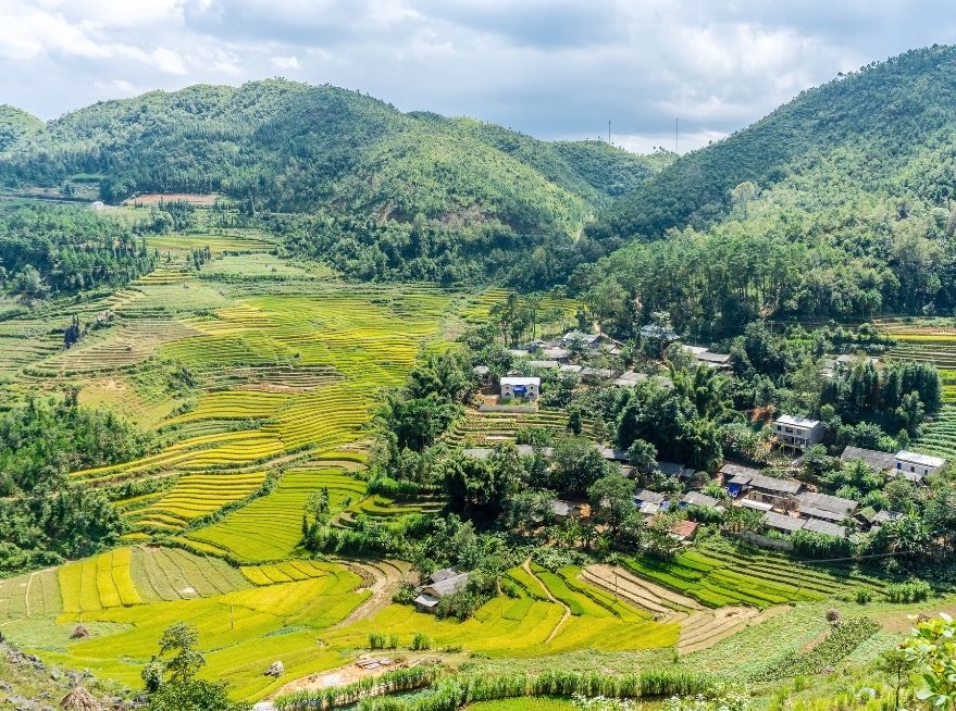
The Ha Giang Loop can be explored year-round, but the best time to visit is from October to April, when the weather is cooler and more pleasant for outdoor activities. The months from September to December are particularly special, as you can witness the blooming of rice terraces and the stunning yellow fields in the region. However, if you plan to travel during the rainy season, from May to September, be prepared for wet conditions and slippery roads.
Conclusion
The Ha Giang Loop is a journey like no other, offering travelers the chance to explore some of Vietnam’s most remote and stunning landscapes. With the help of a detailed Ha Giang Loop Map, you can plan your route effectively, ensuring that you make the most of your time on the road. Whether you’re a seasoned traveler or a first-time explorer, this map will guide you through the incredible beauty of Ha Giang and help you create memories that will last a lifetime.
At Strawberry House, we are committed to providing you with the best resources for a safe and enjoyable journey. Your adventure along the Ha Giang Loop awaits—are you ready to discover the route ahead?
STRAWBERRY HOUSE